
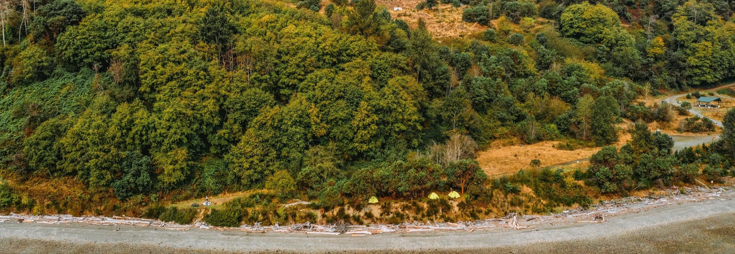
DIRECTIONS TO YOUR CAMPSITE
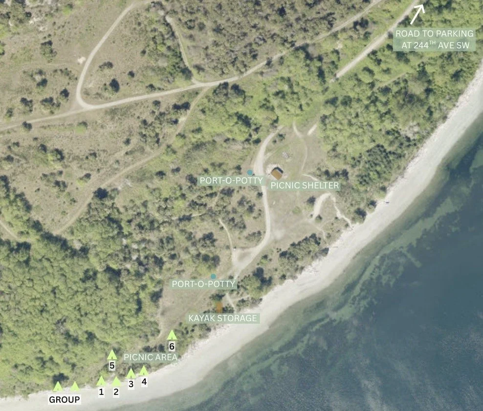
Parking lot for vehicles and trail access is on SW 244th Street (Google Maps link here and GPS coordinates 47.38564509862387, -122.39947726859351). Parking is a ¾ mile walk/bike to the campsite! This is not a drive-in site - pack accordingly. The walk is on gravel service road, downhill in and uphill out.